Terrain Processing
Introduction
Digital Terrain Model refer to a data model that attempts to provide a three dimensional representation of a continuous surface, since terrains are two and a half dimensional rather than three dimensional. Terrains are basic models which come into picture in most of the games, animations and other multimedia and visualization application.
Terrain Geometry can also be stored remotely and recieved progressively when needed and rendered on the fly. Serving and streaming of Terrains can be beneficial and difficult. Dynamic environments such as those used for battlefield visualization involving real terrains and multiple players is an example. Geometry servers are useful to control the level of access of sensitive virtual environments. Thus, remote access of geometry is an interesting mix of data serving and content streaming.
Streaming & Rendering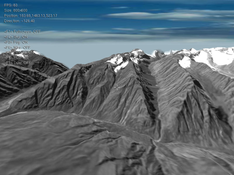
We aim at rendering rich terrains efficiently. Some of the features of the system are ::
- Seamless and fast display of terrains integrating several levels of detail.
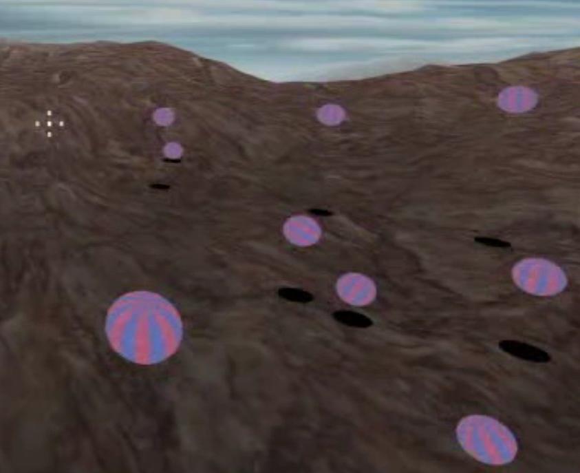
- Real Time editing of Annotations and addition of Dynamic Entities on the terrain.
- Smooth blending of heights over discrete Level of Detail is done to avoid popping of terrain.
- User can record a walkthrough and play it as a demo later.
- View Frustum Culling with Tiles as the basic entity reduces the data to be rendered.
- The stereo modes supported are Anaglyphic, Polarization based Stereo and Shutter Glass Stereo.
- Motion of objects like balls and mercury droplets is simulated.
 The basic objective of a geometry server is to provide each client with data appropriate to it as quickly as possible. Main features of the streaming system developed are ::
- A transparent streaming system which treats remote and local objects without distinction.
- The client module performs caching and predictions needed for better performance and interface with the server.
- A suitable level of detail is sent to each client based on capabilities of rendering hardware.
- Support for Dynamic Objects and local modification.
- Changes to an existing model in the virtual environment are notified to all clients possesing the same.
- The system uses a combination of visibility culling, clientside caching, speculative prefetching, motion prediction and deep compression to achieve performance similar akin to local rendering.
Related Publication
Soumyjit Deb, P.J. Naryanan and Shiben Bhattacharjee - Streaming Terrain Rendering , The 33rd International Conference and Exhibition on Computer Graphics (SIGGRAPH) Interactive Techniques Boston Convention and Exhibition Center, Boston, Massachusetts USA, 30 July - 3 August, 2006. [PDF]
Soumyajit Deb, Shiben Bhattacharjee, Suryakant Patidar and P. J. Narayanan - Real-time Streaming and Rendering of Terrains, 5th Indian Conference on Computer Vision, Graphics and Image Processing (ICVGIP), Madurai, India, LNCS 4338 pp.276-288, 2006. [PDF]
Soumyajit Deb and P. J. Narayanan, Design of a Geometry Streaming System, Proceedings of the Indian Conference on Vision, Graphics and Image Processing(ICVGIP), Dec. 2004, Calcutta, India, pp. 296--301. [PDF]
Associated People
Shiben Bhattacharjee
Suryakant Patidar
Soumyajit Deb
Prof. P. J. Narayanan